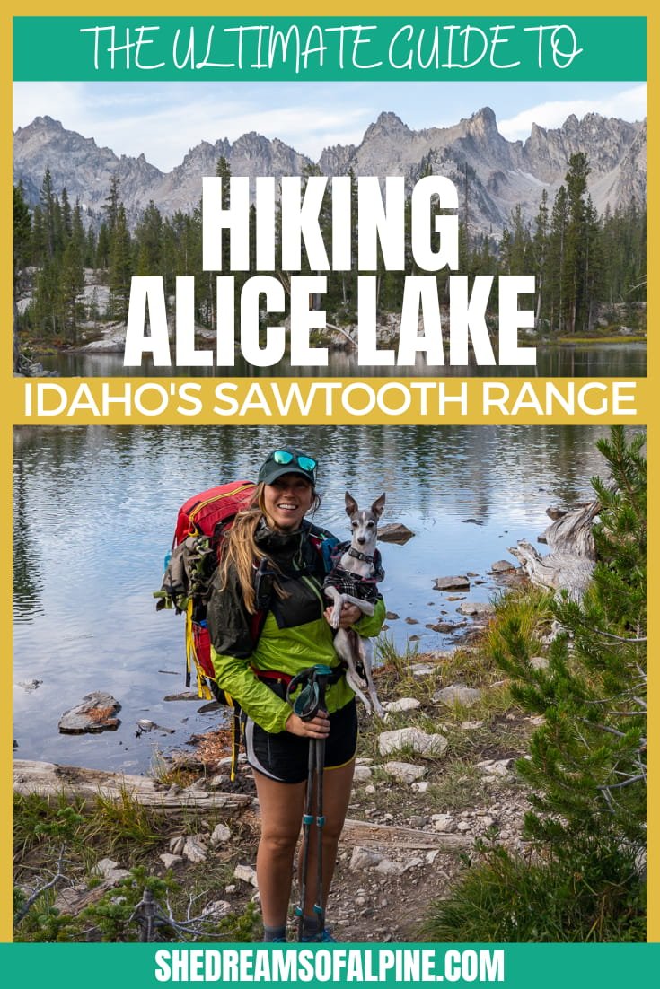
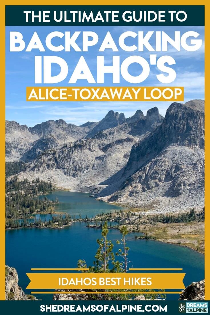
The Ultimate Guide to Idaho’s Alice Lake Hike & Backpacking the Alice Toxaway Loop in the Sawtooth Mountains
I’d dreamt of backpacking and hiking in Idaho’s Sawtooth Mountains for quite sometime. Although I didn’t know much about them, a past coworker of mine once told me the area was one of her favorite places to visit, so I mentally bookmarked the Sawtooth Mountains as a “must-do” future adventure.
When the time finally came for Michael and I to continue our van travels up into Idaho, I immediately did some researching for epic backpacking adventures in the Sawtooths.
That’s when I came across the Alice Lake hike.
I was looking for something beautiful, dog friendly, and easily accomplished in 2-3 days, and Alice Lake met all the qualifications.
In fact, this area of the Sawtooth Mountains absolutely took our breath away.
I’m so glad that our first introduction to the Sawtooth Range was the Alice Lake area, because it is hands-down one of the most beautiful trails I’ve ever been on (and I’ve been on a LOT of beautiful trails).
We decided to do the full Alice-Toxaway Loop during our trip (which, btw is SO WORTH IT), but this guide will also cover the Alice Lake hike which is easily done in a day or extended as a backpacking trip for a chill weekend.
Plus, I’ll share the details about the Alice-Toxaway Loop if you are looking for a bit more of a challenge and extra epic scenery and viewpoints to boot.
Let’s get started shall we?
P.S. Be sure to check out my video of the full Alice-Toxaway Loop if you want to see just how freaking beautiful this trail is. You’ll find it in Section 9!
New to Outdoor Backpacking?
Join me and one badass group of women on a transformational adventure, where you will learn how to confidently go on your first ever (or perhaps your first solo) outdoor backpacking trip without the constant fear of getting lost, the debilitating worry of being unprepared, and the lurking feeling that you lack the "know-how" and skills required to stay safe on the trails. Click below to learn more about my one-of-a-kind backpacking program, Become an Outdoor Backpacking Badass!
WHAT WE WILL COVER IN THIS GUIDE to the alice lake hike
If you’re new to my site, let me tell you one thing: I like to write EPIC trail guides. Like one-stop-shop, absolutely everything you need trail guides.
I want you to know as much as possible for your adventures into the mountains, so you can feel fully ready and prepared for any trip you embark on.
Plus, I’m told organization and planning are some of my biggest superpowers, so I might as well put them to good use here for you. :)
With that said, there is a lot of information in this post, so if you are looking for something specific, feel free to skip ahead to one of the below categories. This Alice Lake trail guide will cover the following:
1. Alice Lake Hiking Trail Specifics - Stats, baby! All the juicy data for the trail. How many miles, elevation gain, & more.
2. Alice Lake Hike Reservations and Permits – The specific permits you need to hike this trail.
3. Alice Lake Trail Map & GPX File – I love maps and outdoor navigation, so I've created a map detailing the whole trail that you can explore. You can also download this file as a GPX file to upload into your own personal GPS device.
4. Best Time to Visit Alice Lake (When to Go) - Details about the best time to hike Alice Lake Sawtooth Mountains and typical weather to expect on your trip.
5. How to Get to Alice Lake in Idaho - Where is Alice Lake located and how do you get there? (Hint: near Pettit Lake, Idaho)
6. Alice Lake Camping - Details on the camping situation in and around Alice Lake.
7. Hazards & Challenges of Hiking the Alice Lake Trail – A short list of the top hazards and challenges you might face along this trail.
8. What to Bring on the Alice Lake Hike - The essential items you should bring when backpacking Alice Lake.
9. Itinerary for Hiking the Alice Lake Trail - I’ll walk you through an ideal itinerary for your Alice Lake hiking or backpacking trip.
10. Backpacking the Entire Alice-Toxaway Loop. – If you’re up for a bigger challenge in Idaho’s Sawtooth Mountains, then I want to share the Alice-Toxaway Loop itinerary and map with you. I think you’ll love it!.
Plus, be sure to check out the bottom of this post to find more ultimate hiking trail guides in the US and other additional hiking, camping and backpacking resources!
GRAB MY [FREE] OUTDOOR BACKPACKER STARTER KIT
I created the Ultimate Outdoor Backpacker Starter Kit for you (and it's FREE)! This starter kit is filled with 14 pages of my best hiking and backpacking tips to help you learn what it takes to become a safe, confident, and self-sufficient outdoor backpacker!
1. Alice Lake Hiking Trail Details
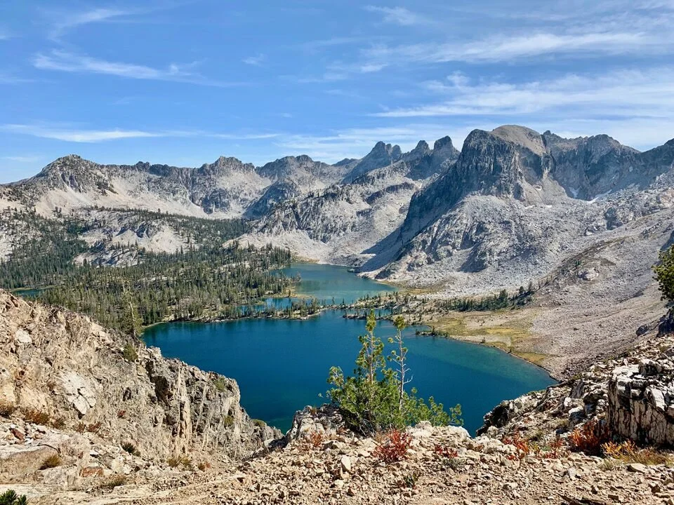
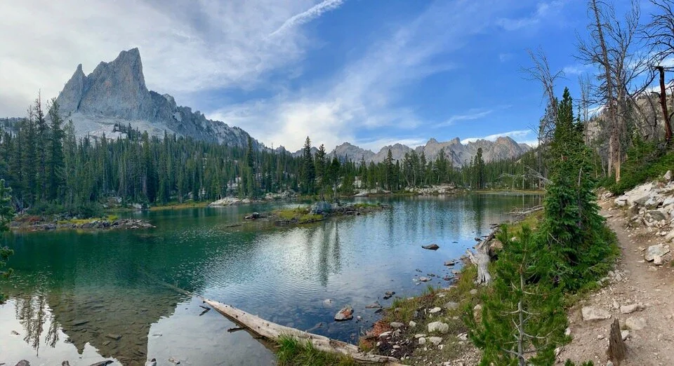
To say the Alice Lake hike is a beautiful hike just doesn’t seem to do it justice. It’s jaw-dropping, exciting, surrounded by tall, jagged peaks commonly called the “Dragon’s Back”, and is a hike filled with so many opportunities for side adventures and extensions.
You can’t go wrong choosing to hike on the Alice Lake trail.
Quick Facts About the Alice Lake Hike:
Trail to Alice Lake: Starts at Tin Cup Trailhead (near Pettit Lake) and heads toward Alice Lake
Type of Trail: Out and Back (if only hiking Alice Lake), can be connected into a loop commonly called the Alice-Toxaway Loop
How many miles is the hike to Alice Lake: ~12 miles round trip, but you can extend the trip to Twin Lakes if you want to hike a bit further (~2 miles extra round trip), OR backpack the entire loop (see section 10 for more details on the Alice Loop)
Total Elevation Gain: ~2000 feet total elevation gain to Alice Lake and back
Alice Lake Hike Trailhead: Tin Cup Trailhead (at Pettit Lake Campground)
Trailhead Elevation: 7,048 feet
How long does it take to hike Alice Lake? Plan a full day for hiking to Alice Lake, especially if you want to spend time relaxing and enjoying the area. The day hike could take anywhere from 5 to 8 hours, depending on your pace.
Alice Lake Crowds: The hike to Alice Lake is a pretty popular hike in the Sawtooth Mountains, especially if you go during the summer and on the weekends. Expect to share the trail, particularly for the day hike with other hiking parties.
Do you need a permit to hike to Alice Lake? Yes, you’ll need a backcountry permit (no fee). See my permit section below for more details.
How difficult is the Alice Lake hike? While there is 2,000 feet of elevation gain on this trail, we found it to be nice and steady (not too steep) and well spread out over the hike. If you’re new to hiking, expect that this will be a physical challenge since the hike is mostly uphill on the way to Alice Lake, but you’ll get a nice consistent downhill for your return back to the car. I’d rate it as a “moderate” day hike, but do consider your own abilities and experience before attempting the trail.
Is there drinking water available along the Alice Lake trail? Yes. There are two big lakes (Pettit Lake and Alice Lake), plus a number of river crossings where you can fill up on water. If you’re day hiking, you may be able to get by with 3 liters of water, but it’s always smart to pack a water filter just in case you need to fill up. Check out my packing list below for my recommended water filters.
Is hiking Alice Lake dog-friendly? Yes! Dogs are allowed to hike with you (on leash) in the Sawtooth Mountains in Idaho. In fact, there are signs in the backcountry on the Alice Lake Trail that showed dogs were even allowed “off-leash” after Labor Day (I’m guessing because the crowds are less).
What kind of fish can I find at Alice Lake? Brook trout are the most common type of fish you’ll find in Alice Lake.
2. Alice Lake Hike Reservations and Permits
Compared to many of my adventures getting permits in California, getting a permit to hike in this area of the Sawtooth mountains is a breeze.
Is a permit required? A permit is required, but it’s simply a self-issued wilderness permit.
Where do I get my permit to hike the Alice Lake Trail? At about 1.2 miles into your hike, you’ll run into free permit box. It’s a wooden stand along the trail located at the wilderness boundary. You won’t miss it!
Do I still need a permit if I’m not backpacking or camping overnight? Even if you’re only day-hiking you still need to fill it out. So, take a moment, fill out the slip of paper, and then continue onwards with your hike.
Other Useful Permit Information and Regulations:
Groups of 8 or more (or any overnight stock use) must obtain their permits from a Forest Service Office.
Groups may not exceed 12 people and 14 heads of stock from May 1-November 30.
Camp at least 100 feet from trails, lakes, and streams (this is a key Leave No Trace principle).
There are no campfires allowed on the Alice-Toxaway Loop, but you are encouraged to bring portable stoves for cooking.
3. Alice Lake Trail Map & GPX File
The trail to Alice Lake is pretty straight forward and easy to follow. The main thing you need to pay attention to is to hike clockwise from Tin Cup Trailhead to go toward Alice Lake.
Your hike will skirt along Pettit Lake as you get started. If you start hiking away from Pettit Lake, then you’re going counter-clockwise (which by the way, is an awesome option for the Alice-Toxaway Loop, if you’re doing that).
Below is my Alice Lake trail map. It details all the key milestones of the hike including the trailhead start.
You can find the “GPX tracks” for this hike to load into your own GPS below.
DOWNLOAD THE GPX FILE FOR THIS TRAIL!
Knowledge is power my friend, and I'm a girl who loves data. Get access to this trails GPX file PLUS my library of GPX files with tracks and waypoints for all the trails loaded onto the She Dreams of Alpine blog.
Load this puppy into your trusted GPS and rest easy knowing you have tracks to follow on your next hike or backpacking trip.
DON’T HAVE A GPS? YOU SHOULD.
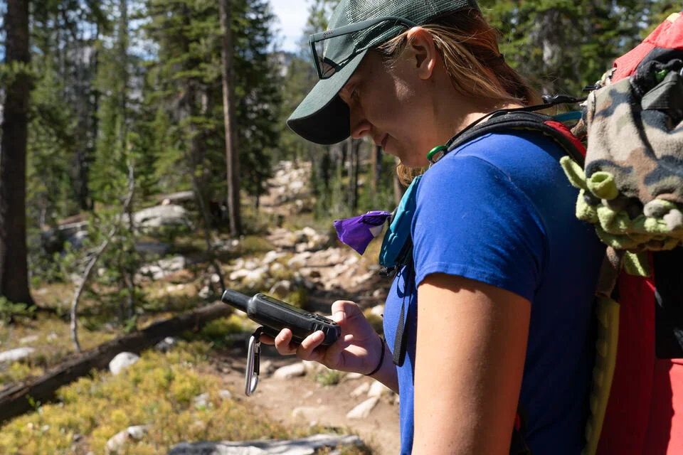
I believe every hiker and backpacker should strive to be self-sufficient, and that includes knowing how to practice smart navigational skills in the outdoors.
This is an important safety skill set that I teach in-depth inside of my backpacking program. There’s no reason to risk getting lost in the outdoors.
Here’s what I recommend to get started:
(Note: This list contains affiliate links)
Gaia is offering a special 10% discount on a premium account to those who subscribe online through my link.
Don’t know where to start? If you need help with some Gaia GPS basics, download my quick Gaia GPS navigation 101 guide.
2) Get an SOS Device: Once you are able to, I recommend investing in some sort of SOS communication device like the Garmin inReach Mini or the Garmin inReach Explorer+ . These devices provide not only GPS tracking capabilities, but also an SOS satellite search and rescue communicator and text communication abilities in the backcountry.
My Go-To Trail Setup: The Gaia GPS app (premium subscription) + the Garmin inReach Mini.
Alternative to Garmin: Pair your Gaia GPS App with the Zoleo SOS device . With this set up, the Gaia GPS App serves as your GPS navigation device, and the Zoleo serves as an SOS/communication device.
Learn more about the best GPS devices for hiking here.
4. Best Time to Visit Alice Lake (When to Go)
While I’m sure the Alice Lake area is beautiful year-round, there are some more optimal times to visit... especially if you’re hoping to avoid snow and experience good weather.
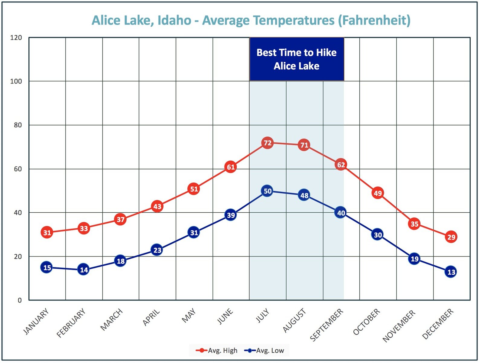
So when’s the best time to go? July, August and September will prove to be the best conditions for hiking or backpacking the Alice Lake trail.
Check out the Alice Lake area weather average temperature map below for reference.
Be prepared before you go. Just like I teach my students in my backpacking program, it’s important that you always research your weather conditions before you go, weeks AND days before your trip.
You never know when weather can change, and it can often happen unexpectedly.
You can check the weather conditions at one of the following resources:
Mountain Forecast – One of my favorite sources for mountain weather forecasts when checking a few days before a trip
Important Notes: This trail has some challenges in the spring and into early June due to snow melt and snow accumulation. There are quite a few river crossing along this trail, and earlier in the season, those crossings will be trickier and potentially dangerous.
5. How to Get to Alice Lake in Idaho
Getting to Alice Lake is pretty simple, and here’s all the info!
As always, driving times will vary depending where you are coming from, but here are a couple estimates from big cities nearby:
Twin Falls, Idaho to Tin Cup Trailhead: ~2.5 Hours
Boise, Idaho to Tin Cup Trailhead: ~3 Hours
McCall, Idaho to Tin Cup Trailhead: ~4 Hours
Getting to the Trailhead
If you’re using Google maps, a quick search of “Tin Cup Hiker Trailhead Idaho” or “Pettit Lake Campground Idaho” will get you where you need to go.
The cell service isn’t great out there though, so be sure to download your map to your device in advance, or print out instructions to get there.
The trail is only about 30 minutes South of Stanley, Idaho. If you’re in Stanley, continue south along Highway 75 for about 18 miles. Turn right at onto Forest Rd 208 (look for signs for Pettit Lake) and follow a gravel road for about 2 miles and turn toward Tin Cup Trailhead when you come to an intersection with several options.
Parking: When we went (mid-September), we had no issues parking in the Tin Cup Trailhead parking area. However, I could easily see this area filling up quickly on the weekends in peak season. If you want to grab a spot at the closest parking area, be sure to get there early.
But there are plenty of places to park in and around the Pettit Lake area, you just might have to walk a little further depending where you end up.
6. Alice Lake Camping Information
You’ve got a few options when it comes to camping at and around the Alice Lake area.
CAMPING NEAR THE TRAILHEAD (PRE-HIKE)
Pettit Lake Campground
There is an established campground right at the Tin Cup Trailhead near Pettit Lake, Pettit Lake Campground, but all the sites are first-come/first-serve and the campground fills up fast.
The campground is open from June to September (it closes on September 21st). Camp sites range from $20 a night for single sites to $40 a night for double sites.
It’s a great little spot, and super convenient for the hiking trail, but again, this place will fill up quick on the weekends in the peak season.
Free Camping
Since the Sawtooth area is a National Forest, there are also ample dispersed opportunities, including pullouts and camping spots that make for great free camping alternatives to the established campground nearby.
We saw several alternative dirt pullouts on our drive into the Tin Cup Trailhead area.
As always, if you choose to free camp in the area the night before your hike, please maintain Leave No Trace principles, and respect the land you’re camping on. We want to keep these places beautiful for everyone.
CAMPING ALONG THE ALICE LAKE TRAIL
If you decide to backpack the Alice Lake trail, then there are some really fantastic spots to camp all around Alice Lake.
If you want to get away from the crowds, head a little bit farther past Alice Lake towards Twin Lakes and camp around there.
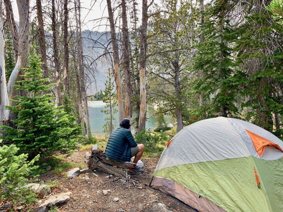
Since Michael and I did the full Alice Toxaway Loop (in 2 days), we opted to camp at Twin Lakes, and we loved it.
Remember: Leave No Trace recommends that you camp at least 200 feet (about 70 adult steps) away from water sources to allow access for wildlife to the water.
The rules of the Sawtooth National Forest recommend camping at least 100 feet (roughly 35 adult steps) away from lakes, rivers, and trails.
7. HAZARDS & CHALLENGES OF HIKING THE ALICE LAKE TRAIL
Besides the natural and inherent dangers and challenges that come with backpacking or hiking in the great outdoors, here are some specific challenges to be aware of on the Alice Lake hike.
River Crossings
As I mentioned in the “When to Go” section, hiking to Alice Lake can be challenging in the spring due to snow run-off which causes river crossing to become more technical and potentially dangerous depending on the water levels.
There are four primary river crossings to get to Alice Lake. When we hiked the trail in mid-September, we were always able to avoid the water by rock hopping or tree-crossing across the water.
However, you may find yourself having to take off your shoes (in order to keep your shoes dry) earlier in the season.
Just be prepared that this challenge exists, and the complexity of the river crossings depends on the time of year and snow run-off into the rivers.
To be extra safe, stop by one of the Sawtooth National Forest Ranger Stations along highway 75 to get updates on current trail conditions and water levels for the river crossings.
Wildlife in the Sawtooth Mountains
You’ll find all kinds of amazing wildlife in the Sawtooth Mountains including deer, moose, mountain goats, mountain lions, gray wolves, and black bears.
Grizzly bears used to inhabit the Sawtooth range, but are now locally extinct.
As always, be bear aware in the backcountry and practice preventing encounters by keeping your food in bear cans if you’re overnight camping in the area, and always, always, pack out anything you pack in.
Learning how to prevent and properly respond to animal encounters in the wild is an absolutely essential skill to learn in the backcountry, and one of many key skills we teach in my backpacking program, Become an Outdoor Backpacking Badass.
Bees
This may or may not be an issue for you when you hit the trails to hike Alice Lake, but we ran into quite a few bees during our time in Idaho. Maybe it was a particularly busy time for bees when we visited, but they were obvious, buzzing, and not shy to explore.
They seemed particularly interested in hanging out around the hood of our car when we were getting our backpacking stuff ready.
Just be prepared, and if you’re allergic to bees, take extra precautions to avoid them (and bring your EpiPen) or find another trail.
Also, avoid wearing dark colors and and the color red – these colors may be seen as a threat to bees and can make them more aggressive. Of course, my backpack was bright red, so it was just completely the wrong color for not attracting bees, haha!
Again, maybe this isn’t the norm for the area, but it was what we experienced. We never got stung, but I was definitely on edge around the parking lot where they were congregating. We ran into fewer bees on the trail itself.
8. What to Bring on the Alice Lake Hike
Here’s a rundown of the essentials you need to bring with you, though it will vary depending on whether you day hike Alice Lake or go backpacking, and this list doesn’t cover everything you might need.
For a look at what we recommend for day hikes, check out our full Day Hiking Gear Packing List.
If you are backpacking Alice Lake, here’s a quick look at what we recommend:
Note: The list below may contain affiliate links.
Check out my full backpacking checklist here:
WANT TO PRINT OUT MY FULL BACKPACKING PACKING CHECKLIST?
Don’t leave anything behind on your Alice Lake backpacking trip. Grab my Packing Checklist below! In this freebie, you’ll get access to:
A Full Backpacking Gear Checklist for 2-5 Day Backpacking Trips
A Visual Backpacking Gear Checklist
Layering Essentials Tip-Sheet
25+ Backpacking Food Ideas for your upcoming Alice Lake Hike
9. Itinerary for Hiking the Alice Lake Trail
If I were planning a day hike to Alice Lake, here’s what things would look like.
A TYPICAL ALICE LAKE HIKE ITINERARY
Drive in the night before your hike and camp either at the Pettit Lake Campground or in nearby Forest Service land.
The morning of your hike, arrive early at the Tin Cup Trailhead and start hiking with the coolest temps (remember, your hike is mostly uphill on the way to Alice Lake).
Take your time up the trail, tackle the river crossings on your way up, and enjoy the scenery on your challenging but doable uphill journey to Alice Lake.
When you get to Alice Lake, look off to the towering peak opposite of the lake – this peak is Idaho’s “El Capitan” and is a unique feature by the lake.
Enjoy lunch at Alice Lake, and if you have some extra energy and time in your schedule, I highly recommend continuing your journey onwards to Twin Lakes. Just be aware that this will add a couple miles to your trip.
The Twin Lakes area is beautiful though, and well worth the extra push if you can swing it.
Descend the trail the same way you came, but enjoy the ease of downhill on your way back to the trailhead.
End your day with some warm food and a hot springs dip in Stanley, Idaho. With a little bit of research, you’ll find some excellent spots to take a dip nearby.
Alice Toxaway Loop Video
Watch my short video of hiking the Alice-Toxaway Loop!
10. Backpack the Entire Alice-Toxaway Loop
If you’re up for an extra challenge, I highly recommend the Alice-Toxaway Loop.
The Alice-Toxaway Loop is roughly 19 miles long with about 3,500 feet of total elevation gain. This loop can be tackled in a day (if you’re in really good shape), but is more enjoyable as a 2-3 day backpacking trip.
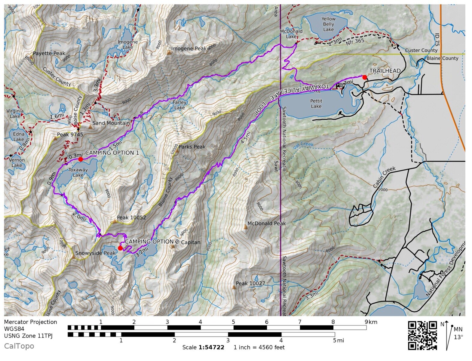
Below is a look at the Alice-Toxaway Loop map (and you can also grab the GPX tracks for this if you join my GPS Tracks Library in Section 3).
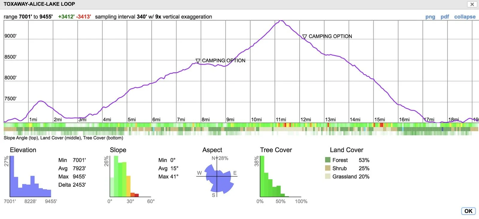
Notes About the Alice-Toxaway Loop: Hiking the trail counter clockwise is actually more gradual of an uphill than hiking it clockwise, and you get to save the best views for last. This is what we did.
You can see the elevation gain profile below (this is counter clockwise from left to right from Tin Cup Trailhead):
Here are a couple of itinerary options:
2 Days on the Alice-Toxaway Loop:
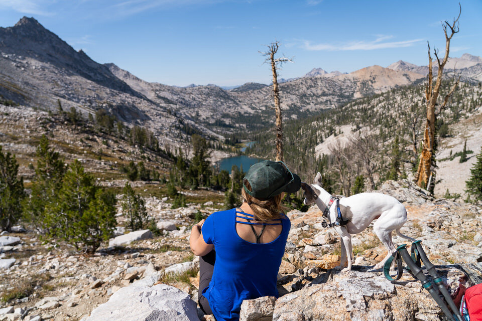
Day 1: Start at Tin Cup Trailhead. This will be your “biggest” day. Hike counter-clockwise toward Toxaway Lake. You’ll be hiking uphill most of the day until you make it to the pass that overlooks Twin Lakes (most epic view ever!), then hike downhill to camp at Twin Lakes for the night. While challenging due to the length and mostly uphill, we found this very enjoyable regardless. Roughly 12 miles and 3,500 feet of gain.
Day 2: Descend from Twin Lakes all the way back to Tin Cup Trailhead. You’ll pass by Alice Lake on your way down. Easy, downhill day. Roughly 7 miles, all descent.
3 Days on the Alice-Toxaway Loop:
Day 1: Start at Tin Cup Trailhead. Hike counter-clockwise toward Toxaway Lake. Camp the first night at Toxaway Lake. There aren’t a ton of obvious campsites around Toxaway, but you can certainly find some. Roughly 8 miles, 2,100 feet of gain.
Day 2: Hike from Toxaway to Twin Lakes. The hike to the pass will be uphill, but then you’ll be downhill the rest of the way to Twin Lakes. Camp at Twin Lakes. Roughly 4 miles and 1,400 feet of gain. (Another option would be to continue your hike to Alice Lake and camp there.)
Day 3: Descend from Twin Lakes all the way back to Tin Cup Trailhead. You’ll pass by Alice Lake on your way down. Easy, downhill day. Roughly 7 miles, all descent.
Want to extend it even farther? There are so many hiking options around this area to create an even longer backpacking trip. Just pull up a map, and you can extend your hike up to Edith Lake even and back around. The options are limitless out here!
I hope you enjoyed this epic trail guide to the Sawtooth Mountains Alice Lake Trail in Idaho.
If you have any questions, leave us a comment below! We’d love to hear from you. Happy Hiking!
LOOKING FOR MORE HIKING & BACKPACKING ADVENTURES?
If you are looking for additional hiking & backpacking bucket-list adventures, check out our resources below:
ESSENTIAL HIKING & BACKPACKING RESOURCES
Also be sure to check out these essential hiking resources!
7 Tips to Hiking and Summiting Your First Fourteener Mountain
Essential Backpacking Hygiene Tips & Feminine Care in the Outdoors
Cheers,
Allison - She Dreams of Alpine



















27 of the Absolute Best Hikes in Yosemite National Park to Put on Your Hiking Bucket List | Yosemite National Park is one of the most beautiful national parks in the entire United States, and one of the best ways to explore the park is via one the many amazing hiking trails. In this post, I’ve detailed 27 of Yosemite’s top hiking trails, ranging from difficult to easy, that give you epic views of Yosemite’s grand backcountry and some of Yosemite’s most famous landmarks. You’ll only fall more in love with Yosemite after going on one of these hikes! | shedreamsofalpine.com